A series of chilly weather warnings for wind and rain were issued for Sunday, Monday and Tuesday after Storm Eowyn hit the British Isles with hurricane force winds.
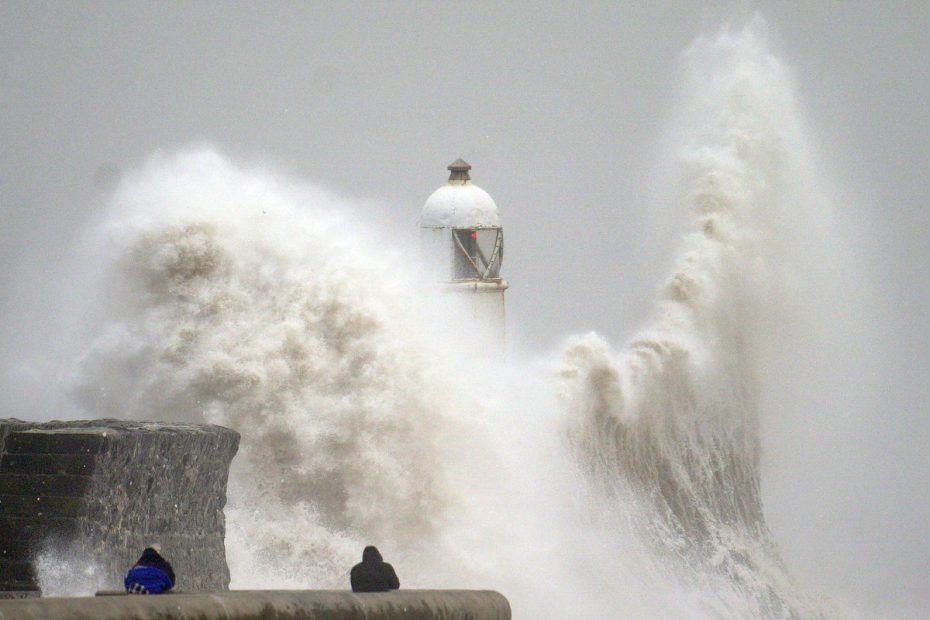
Flights were cancelled, major rail lines closed and ferry services halted on Saturday after winds of over 100mph hit parts of Britain throughout Friday. More than a million people were without power due to the violent storm.
A rare red weather warning was lifted on Friday from Scotland and Northern Ireland, where Storm Eowyn damaged buildings, uprooted trees and caused power outages.
Follow our live blog for the latest weather updates
But the Met Office has issued weather warnings until Tuesday as a new low-pressure system – dubbed Storm Herminia by Spanish forecasters – moves in this weekend, moving in from the south-west as Eowyn passes.
A wind warning was lifted from the west coast of England, Wales and south-west Scotland at 5pm on Sunday after winds of up to 82mph were recorded in south Cornwall.
A yellow wind warning remains in place extending from the south coast to north-east England from 10pm on Sunday until 7am on Monday, while a rain warning is in place for southern and central England and Wales until 6am on Monday.
A new rain warning for most of Wales remains in force until 11.59pm on Monday.
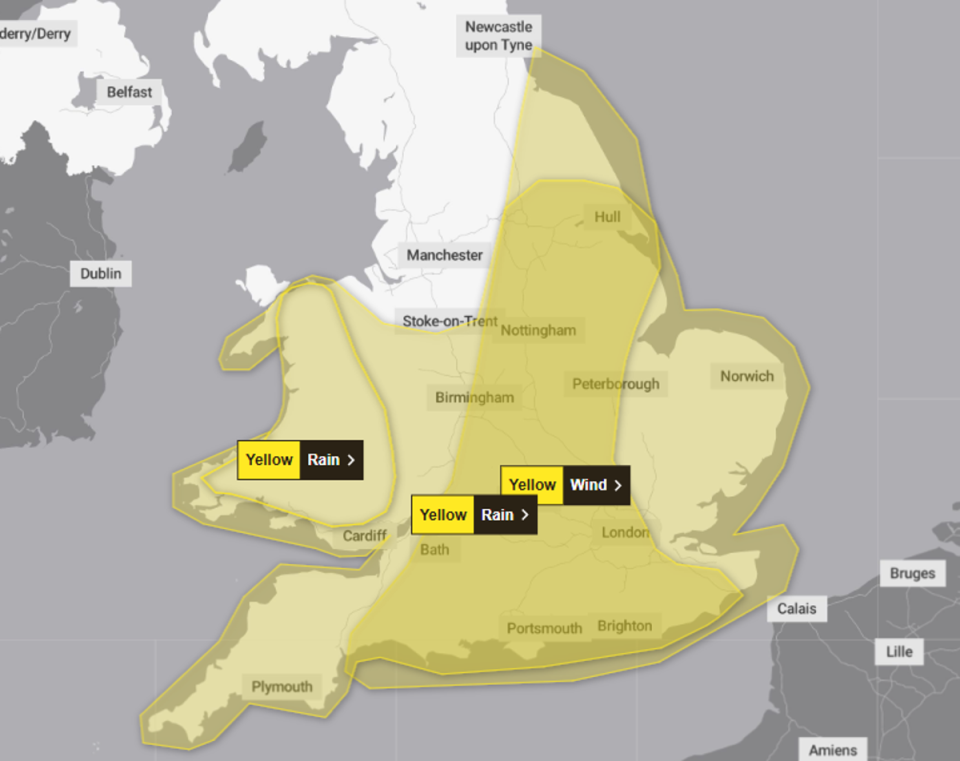
Three weather warnings are in effect from Sunday evening to Monday morning (Met Office)
Up to 80mm of rainfall could fall in some places during the period from two separate periods of heavy rain and thunderstorms, while 10 to 20mm should fall quite widely and 30 to 50mm could fall on high ground, the Met Office said.
Flooding to homes and businesses may occur in the warning area, along with power outages and difficult driving conditions. There is also a “remote chance” that fast-flowing or deep floodwaters could pose a life-threatening threat, the Met Office said.

The Environment Agency had issued 151 flood warnings and 23 flood warnings on Sunday evening (Environment Agency)
Met Office meteorologist Jonathan Vautrey said: “Looking into Sunday, it's going to be a reasonably good start for many areas – another high pressure ridge is coming in which will keep the situation fairly stable, with some sunny spells.
“However, the cloud will build as we see a low pressure system moving southwest. This will bring heavy rainfall to South West England and Wales from around mid-morning, spreading to Northern Ireland and Northern England later in the afternoon.
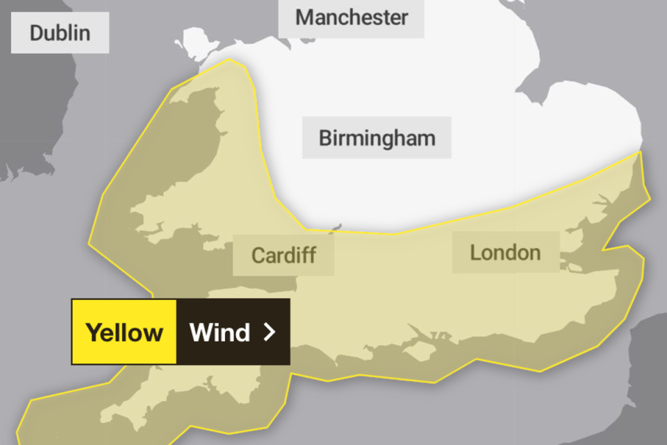
There is also a wind warning in force until 6am Tuesday (Met Office)
“With this feature, the wind will also increase. It certainly won't be as strong as Storm Eowyn. But because the wind is from the south-west, the more southerly areas of England will see the strongest gusts, compared to areas further north.”
The start of next week will bring little respite for those in the south. Southern parts of England and Wales are under a yellow wind warning from 6am Monday to 6am Tuesday, which could bring a “period of strong and gusty south-westerly winds”.