Virginia Norwood, an aviation pioneer who invented the scanner used for more than 50 years to map and study the Earth from space, has died at her home in Topanga, California. She was 96.
Her death was announced by the United States Geological Survey, whose Landsat satellite program relies on her invention. Her daughter, Naomi Norwood, said her mother was found dead in her bed on the morning of March 27.
Orbiting the Earth every 99 minutes, the Landsat satellites, which fly at 700 kilometers above the surface, have captured a complete image of the planet every 16 days since 1972. These images have provided powerful visual evidence of climate change, deforestation and other shifts affecting well-being.
Mrs. Norwood, a physicist, was the person primarily responsible for designing and championing the scanner that made the program possible. NASA has called her “the mother of Landsat.”
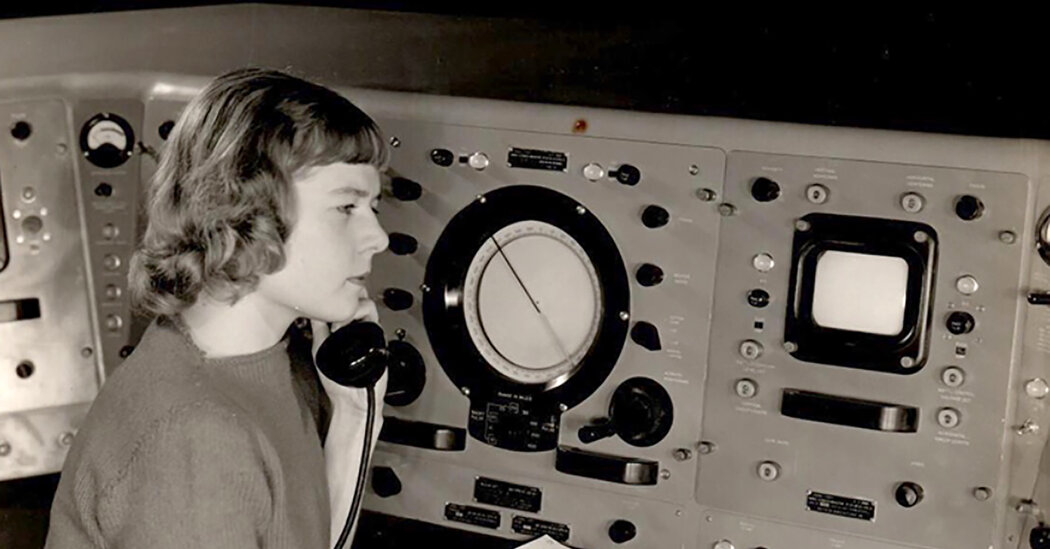
At the dawn of the space exploration era in the 1950s and 1960s, she worked at Hughes Aircraft Company developing instruments. Belonging to a small group of women in a male-dominated industry, she was more notable for her shrewdness.
“She said, ‘I was kind of known as the person who could solve impossible problems,'” Naomi Norwood told NASA for a video on its website. “So people brought things to her, even bits from other projects.”
In the late 1960s, after NASA’s lunar missions returned spectacular photos of Earth, the director of the Geological Survey thought that photos of the planet from space could help the agency manage land resources. The agency would work with NASA, which would send satellites into space to take the pictures.
Ms. Norwood, who was part of an advanced design group in Hughes’ space and communications department, researched scientists specializing in agriculture, meteorology, pollution and geology. She concluded that a scanner that recorded multiple spectra of light and energy, such as one that had been used for local agricultural observations, could be adapted for the planetary project the Geological Survey and NASA had in mind.
The Geological Survey and NASA planned to use a giant three-camera system designed by RCA, based on television tube technology, that had been used to map the moon. Most of the 4,000-pound payload on NASA’s first Landsat satellite was reserved for the RCA equipment.
Ms. Norwood and Hughes were told that their multispectral scanner system, or MSS, could be included if it weighed no more than 100 pounds.
Mrs. Norwood had to scale back her scanner to capture only four energy bands in the electromagnetic spectrum instead of seven as she had planned. The scanner also had to be very accurate. In her first design, each pixel represented 80 meters.
The device had a 9-by-13-inch mirror that thumped noisily back and forth in the scanner 13 times per second. The scientists at the Geological Survey and NASA were skeptical.
A senior Hughes engineer took the device on a truck and drove across California to test it and convince the doubters that it would work. It did – spectacularly. Mrs. Norwood hung one of Yosemite National Park’s Half Dome pictures on the wall of her home for the rest of her life.
The first Landsat launched into space on July 23, 1972. Two days later, the scanner returned the first images of Oklahoma’s Ouachita Mountains; they were amazing. According to a 2021 article in MIT Technology Review, a geologist tore up. Another, who was skeptical about the scanner, said: “I was so wrong here. I’m not going to eat crow. Not big enough. I’m going to eat raven.”
The RCA system would be the satellite’s primary recording instrument and the MSS a secondary experiment.
“But once we looked at the data, the roles changed,” Stan Freden, the Landsat 1 project scientist, said in a NASA report.
The MSS turned out to be not only better, but also more reliable. Two weeks after launch, power surges in the RCA camera-based system endangered the satellite and forced the camera to be shut down.
Over the next 50 years, new Landsat satellites replaced earlier ones. Ms. Norwood oversaw the development of Landsat 2, 3, 4, and 5. Landsat 8 and 9 are currently orbiting Earth and NASA plans to launch Landsat 10 in 2030. Each generation of satellite has added more imaging capabilities, but always based on Ms. Norwood. Norwood’s original concept.
The Landsat program has mapped changes on the planet caused by climate change and human activity. They include the near disappearance of the Aral Sea between Kazakhstan and Uzbekistan, the shrinking of the Great Salt Lake in Utah, the changing shape of the Mississippi Delta, and the deforestation and increasing agricultural use of land in Turkey and Brazil.
Virginia Tower was born on January 8, 1927 in Fort Totten, NY, to John Vogler and Eleanore (Monroe) Tower. Mrs. Tower was a housewife and also a linguist who spoke nine languages. Mr. Tower was a decorated army colonel with a master’s degree in physics who eventually taught at Carnegie Tech (now Carnegie Mellon University).
He encouraged Virginia to study math and physics and made her first slide rule with her when she was 9. As a military family, they moved often and lived in Panama, Oklahoma and Bermuda, among other places. Virginia attended five different high schools before graduating as a salutatorian from Germantown High School in Philadelphia.
Her school counselor suggested she become a librarian, an advice she ignored and instead applied to the Massachusetts Institute of Technology, where she was one of about a dozen women in her new class.
A day after graduating from college in 1947, she married Lawrence Norwood, a graduate student who had been her calculus instructor during her third semester. They had three children: Naomi, David and Peter. The marriage ended in divorce and Mrs. Norwood married Maurice Schaeffer, who died in 2010. She is survived by Naomi and Peter; a sister, Barbara; five grandchildren and three great-grandchildren.
After graduating from college, Ms. Norwood encountered the prejudices that then pervaded society, according to the MIT and NASA articles. During an interview with Sikorsky Aircraft, she asked for a salary commensurate with the lowest rank in the civil service, but was told the company would never pay a woman that much.
She withdrew her application from a nutrition lab after being asked to promise not to get pregnant.
She had three interviews with Remington, the arms manufacturer, in which she outlined how a mathematician on the workforce could improve the company’s operations. The hiring manager called to say her idea was brilliant, but the company was going to hire a man instead.
In desperation, she took a job selling women’s blouses at a department store in New Haven, Conn.
Eventually, she and her husband were hired by the US Army Signal Corps Laboratories in Fort Monmouth, NJ. She worked in the weather radar division, where she designed a radar reflector for weather balloons that could detect previously untraceable winds at 30,000 feet.
She later moved to an antenna group, where she worked on antennas that used microwaves, designing one that remains a secret. In 1953, she and her husband moved to California and began working at Sylvania Electronic Defense Labs in Mountain View, where she set up the company’s first antenna lab.
A year later, the couple moved to Los Angeles, where she was hired by the research and development division of Hughes Aircraft, becoming the only woman among the division’s 2,700 employees. In 1957, promoted to leader of the microwave group in the company’s rocket lab, she became the first woman at Hughes to join the engineering staff.
A man, confronted by Ms. Norwood as his boss, resigned, saying he didn’t want to work for a woman, according to the MIT Technology Review article. He returned some years later and asked for a job, but she refused.
In her new role, Ms. Norwood designed the transmitter and receiver for the world’s first communications satellite. A few years later, NASA sent a lander called the Surveyor to the moon to explore possible landing sites for astronauts. Ms. Norwood’s team designed the equipment the lander used to communicate with the ground control.
In the 2020 article on the NASA website calling her the “mother” of Landsat, Ms. Norwood said she felt comfortable with the name.
“Yes, I like it, and it’s appropriate,” she said. “I made it, I born it, and I fought for it.”