“We are moving into a future where these drones will fly themselves over the countryside,” says McKenna. “But the long-term future of this software is that it will fly people around.”
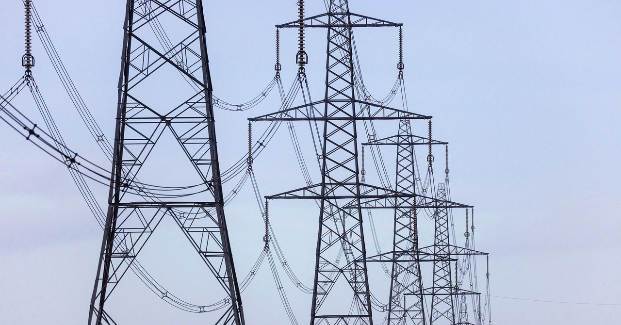
The relationship has become more concrete with Britain’s National Grid, which manages the country’s energy supply, after the organization pledged funds to accelerate the development of Sees.ai’s technology. The first goal of the partnership is to prove that the system can be used to better maintain the network’s 21,900 steel pylons.
The network needs constant adjustments to remain reliable, and regular inspections are important. The National Grid has 99.99 percent reliability, something it aims to improve by locating critical problems long before failures occur. In the wet climate of the UK there is a high risk of corrosion which is difficult to stop once it has started. Pylons must be replaced when the rust has compromised their structural integrity, so early detection saves costs in the long run.
The National Grid spends around £16 million each year painting its pylons, and expects it to cost £35 million over the next five years to replace corroded steel. Considering the high cost of R&D, Sees.ai’s drone system is not necessarily cheaper than other inspection methods, but the National Grid expects it to allow for more frequent and timely data collection, which in turn will save costs by providing more targeted asset replacement. If the trials are successful, the National Grid expects to save more than £1 million for UK consumers by 2031.
But until cost-effective drones are widely deployed, the only option is to use helicopters. A helicopter can inspect 16 pylons every hour for £2,000 an hour, but flying a VLOS drone isn’t much better as it’s cumbersome and slow with the pilot below. On a good day, VLOS drone teams cannot inspect more than 10 pylons. “It’s the human element that’s causing the problems,” said Mark Simmons, National Grid’s condition monitoring manager.
Sees.ai isn’t alone in tackling this problem, but the systems many other companies rely on use GPS and compass for positioning. The problem is that these technologies are vulnerable to interference, especially when they are near steel or strong electromagnetic fields, which occur around power lines. Relying on pre-existing data can also be precarious, as the world is constantly changing.
Also, according to David Benowitz, head of research at the research platform Drone Analyst, GPS technology isn’t always accurate, especially when used to measure altitudes or in rural areas with poor satellite coverage. Because there will always be that ‘bubble of doubt’, he says, there is a greater risk of collisions in crowded airspaces. With more vulnerability comes more risk.
So the only way to roll out these technologies is to mitigate the risk in other ways, such as flying simpler flights further away from potential collisions. But with each constraint imposed, “the applicability and scalability of the solution diminishes,” Benowitz says. If we want to replace manned helicopters, we need to develop a solution that “doesn’t have these limitations” that allows us to safely perform overviews and detailed inspections of assets across most of the network, not just remote parts.
For this to happen, there must be more reliable and robust technologies: every operating system must have multiple layers of security. “To fly close enough to the masts to get the best data, we need more intelligence than GPS,” says Hjamlmarsson. But there also needs to be a change between regulatory bodies like the FAA and the CAA to create the space for these more advanced systems to develop and properly test so that they can one day be proven to be safe. “It’s the chicken-or-egg scenario,” Benowitz says. “These systems are not state-of-the-art, so rolling them out at scale and at cost is no problem, but the regulations must be up-to-date.”