Sailing drone
Science fiction often paints a terrifying picture of the future – think of aliens decimating humanity, à la The War of the Worlds. But sometimes the future that becomes the present can be pretty amazing – who doesn’t love successful space launches that majestically catapult people into the sky?
Or take the Earth’s oceans, which are currently in the midst of a technological revolution that has gone largely unnoticed outside of some very geeky circles.
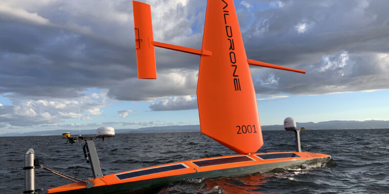
“We’re on the verge of a proliferation of many autonomous vehicles in the ocean,” said Alex De Robertis, a biologist with the Alaska Fisheries Science Center of the National Oceanic and Atmospheric Administration (NOAA). “Things that were science fiction not so long ago are now kind of routine.” So do saildrones, which look like oversized orange surfboards, each with a hard carbon fiber sail (called a wing) and a stash of scientific equipment.
Booming
Saildrones are sailboat-like unmanned surface vehicles (USVs) that navigate the oceans on wind and solar power, although larger versions do have a diesel back-up engine. Remote pilots working for Saildrone (the company, capitalized) can direct a Saildrone (the USV, not capitalized) via satellite-communicated commands, which provide a designated path, called a corridor, to get to a target waypoint to come. The drone’s software autonomously adjusts the wing to keep it on course (pilots cannot directly control this hardware). Saildrones only use wind and ocean currents and sail at about 3 knots on average, or about 3.5 mph.
NOAA and other science teams are tasking Saildrone with deploying these shoddy USVs all over the Earth’s oceans. Saildrones serve as mobile meteorological stations, biological monitoring devices and even ocean floor mapmakers, all without the need for humans on board. They can survive frighteningly high waves, hurricane-force winds and ice-strewn seas, and they can stay out for months.
“The ocean covers 70 percent of the world, [but] when you think about the actual volume, we know so little about it,” said Noah Lawrence-Slavas, an engineer at NOAA’s Pacific Marine Environmental Laboratory (PMEL). Saildrones could offer some answers.
Drones at sea
Saildrone offers its craft in three sizes. The Explorer is the little workhorse: a 25-foot wind-powered vehicle that can sail the seas for a year. With sensor packages powered by solar panels, it can track meteorology and ocean chemistry, track fish and/or measure carbon dioxide at the ocean-atmosphere interface. The 33-meter Voyager is equipped with diesel fuel in addition to wind and solar power. It can map the ocean floor to a depth of 300 meters and is used for maritime security. The longest, largest option, the Surveyor, is designed for deep ocean mapping, down to 7,000 meters. The first Surveyor was 22 meters long, but new vehicles will be 25 meters long.
The Voyager and Surveyor have fewer sensor options as their payloads are optimized for mapping and maritime security, but the Explorer can have between 15 and 20 sensors configured in a customizable package for customers, said Matt Womble, Director of Ocean Data Programs at Saildrone.
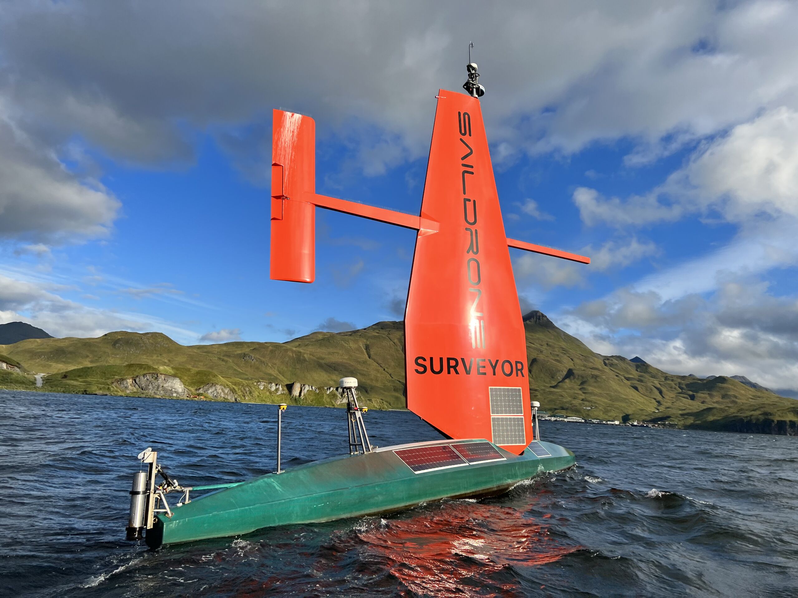
A Surveyor-class saildrone.
Sailing drone
That kind of customization wasn’t always an option. Just over a decade ago, Lawrence-Slavas recalls, PMEL began exploring ways to replace or supplement observations on ships, in part because ships are incredibly expensive. In 2014, Saildrone got in touch to give a presentation about its concept vehicle’s successful journey from San Francisco Bay to Hawaii, he said. Crossing a significant portion of the ocean autonomously piqued PMEL’s interest, but there was still a big gap when it came to usability.
“They had a vehicle, but the vehicle didn’t measure anything,” Lawrence-Slavas said. “[PMEL is unique because] for example, we can design a sensor or system from the ground up.” In 2014, to facilitate the development of saildrone sensors, NOAA entered into a Research and Development Collaboration Agreement, or CRADA, with Saildrone. CRADAs set out project goals, spell out intellectual property agreements and streamline paperwork, he said.