The traffic jams stretched from the Russian city of Belgorod to the Ukrainian border. Google Maps marked the congestion with red and orange, as in all countries where the app is used to track traffic. But the GPS satellites that sent the positions of these vehicles to Google didn’t pick up an ordinary traffic jam. This was 40 kilometers of traffic caused by Russian troops.
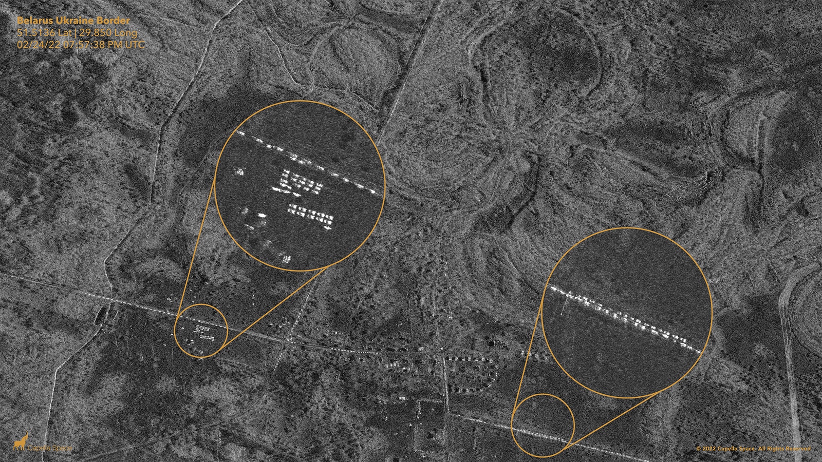
That convoy proved to be an early warning that the Russian troops gathered on the Ukrainian borders were on their way. It was first observed last Thursday at 3:15 a.m. by Jeffrey Lewis, a professor at the Middlebury Institute of International Studies (MIIS), a California graduate school — hours before reports of the first explosions in Ukraine hit the headlines. But he didn’t come by accident. Lewis got a tip from a radar image taken by a commercial satellite company called Capella Space, which showed Russian troops lined up in columns near Belgorod along the road. “When the Russians camp for a long time, they park their tanks in a square and set up tents,” Lewis says.
But this satellite image showed troops in a very different formation. There were no tents; they were ready to move. When one of Lewis’s colleagues started looking for the routes this motorcade might take to get to Ukraine, he found the traffic jam. “It’s really a story about merging different kinds of data,” Lewis says.
Then, on Feb. 28, Google said it would temporarily disable live traffic updates in Ukraine “after consulting multiple sources on the ground, including local authorities.” Google did not explain why it was concerned about the feature. But researchers speculate that the company is concerned that traffic data revealing the location of troops or refugees could be used to inform military strikes. “You can understand why Google wouldn’t want to be a party to providing targeting data in an international conflict,” Lewis says.
There are currently about 50 working satellites in the skies over Ukraine, estimates Todd Humphreys, a professor at the University of Texas. Those satellites have become an important part of Ukraine’s efforts to fend off a Russian invasion. The government there has been calling for satellite imagery to provide clues as to where Russian troops might move.
US authorities gave Ukrainian President Volodymyr Zelensky a satellite phone so they could keep in touch. according to CNN† And Ukraine is also flying drones made by a Turkish company, Bayraktar, that allow some of its models to be controlled remotely via a satellite link. But Ukraine’s reliance on commercial satellites raises concerns about the power they give to the companies they control, as well as the risk of satellite companies being dragged into the conflict.
This is not the ‘world’s first satellite war’. That title was given to the Gulf War three decades ago. Since then, space has become a normal part of modern conflict, said Almudena Azcárate Ortega, an associate researcher at the United Nations Institute for Disarmament Research (UNIDIR). “In recent years, there has been a tendency to outsource much of this work, as private companies have specialized knowledge and are often better able to develop and deploy certain types of technology in space,” Ortega said. adding that many space objects are now called ‘dual-use’. “That means one satellite can be used simultaneously for military purposes, as well as for civilian everyday things,” she says.
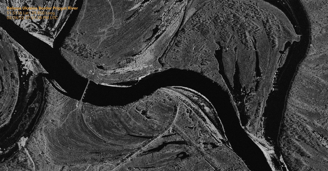
At this time of year, the sky of Ukraine is covered with clouds. Companies are now in high demand if they can produce a type of data called radar that works at night and can see through clouds. Radar images are generated by Synthetic Aperture Radar (SAR) satellites, which map the world in a way similar to how bats navigate in the dark — by emitting radio waves and measuring how their signals are reflected. To carry out their work, open source researchers like Lewis buy radar data from companies like Capella and Planet, both based in San Francisco. They also have to pay for software, such as ENVI, to interpret that radar data and convert it into images. His team’s ability to use this software is the result of years of training, he adds. “Three years ago we couldn’t have done this.”
Open source researchers aren’t the only ones asking for this data. Soldiers want it too. “We desperately need the opportunity to watch the movements of Russian troops, especially at night when our technologies are blind,” Ukrainian Deputy Prime Minister Mykhailo Fedorov said on March 1. letter posted on Twitter, Fedorov called on eight commercial satellite companies to send SAR satellite data to help Ukrainian armed forces see Russian troop movements through clouds. One of the companies that responded was Capella. Its founder and CEO, Payam Banazadeh, says the company provides satellite images of Ukraine to both the Ukrainian and US governments.